Meghalaya
It was formed on 21st January, 1972, carving out from Assam.
- The United Khasi Hills
- Jaintia Hills
- Garo Hills
Borders: Bangladesh provinces of Mymensingh and Sylhet (south), Bangladesh province of Rangpur (west), Assam (north & east).
Capital: Shillong
Location: Northeast India

Cherrapunji
Cherrapunji, also known as Sohra, is a sub-divisional town of East Khasi Hills district of Meghalaya. The Khasi people are the native inhabitants of Sohra. Between 16th century & 18th century, these people were ruled by their tribal Syiems (chiefs) of Khyriem in the Khasi Hillls.
Double Decker Bridge, Nohwet Living Root Bridge

Noh Ka Likai Falls & Polo Orchid Resort
Polo Orchid Resort Place: CherrapunjiState: MeghalayaCountry: IndiaNoh Ka Likai Falls - The Fall Of Likai It bears the sorrowful incident of Ka Likai, who killed herself by jumping off a cliff because of the death of her daughter, who was killed by her second husband.
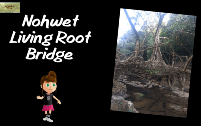
Nohwet Living Root Bridge
Village: Nohwet Rubber tree: Planted in the year around 1840Length: 300m approx. Stairs: 500 approx.A walking stick will be helpful to walk up & down the stairs

Double Decker Bridge
Local Name: Sohra Total Ride Time: 6hrs to 7.5hrs Essentials: Water bottles Handcarchives Light shoes Essentials: Light waight dresses will be better Phones Walking Stick Purse Optional: You can take camera with youDouble Decker Bridge Also known as Umshiang...
Dawki
Dawki is a town in West Jaintia Hills district of Meghalaya. It is also spelled as Dauki. Shillong, Jowai & Silchar are the nearest cities.
India-Bangladesh Border & Umngot River
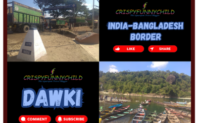
India Bangladesh Border & Dawki
Place: DawkiState: MeghalayaRiver: Umngot River Birth of Bangladesh after Bangladesh Liberation War of 1971 Birth of Burma in 1937 Partition of Bengal in 1905 & 1947 British East India Company 1773 - 1858British Raj 1858 - 1947Independence DaysIndia 15th August,...